Quick Facts
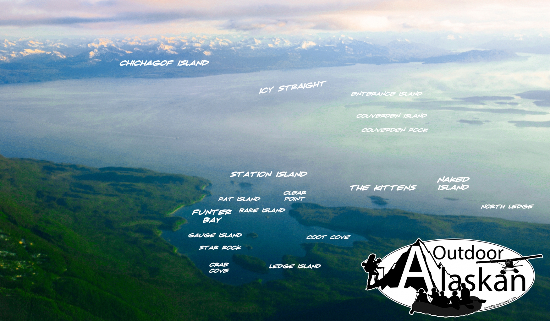
on W coast of Mansfield Peninsula 19 mi. SW of Juneau, Alex. Arch. 2 miles long.
HistoryNamed in 1883 by W. H. Dall, U.S. Coast and Geodetic Survey (USC&GS), for Captain Robert Funter, English explorer, who mapped parts of the NW coast of North America in 1788. Name published in the 1883 Coast Pilot (p. 183).
Pictures of, from, or near Funter Bay.
Auke,
Archipelagos:Bars:Cohen Reef, Dornin Rock, Eagle Reef, Faust Rock, Favorite Reef, George Rock, Gibby Rock, Hanus Reef, Horse Shoal, North Ledge,
Bays:Adams Anchorage, Auke Bay, Auke Nu Cove, Barlow Cove, Coot Cove, Crab Cove, Curlew Ledge, Funter Bay, Game Cove, Halibut Cove, Hand Trollers Cove, Hawk Inlet, Howard Bay, Indian Cove, Lena Cove, Piledriver Cove, Pileriver Cove, Shelter Cove, Swanson Harbor, Tee Harbor, Whitestone Harbor,
Beaches:Capes:Point Augusta, Auke Cape, Barlow Point, Clear Point, Point Couverden, False Arden, False Point Retreat, Hawk Point, Point Howard, Indian Point, Inspiration Point, Point Lena, Point Louisa, Mansfield Peninsula, Point Marsden, Outer Point, Piling Point, Point Retreat, Point Stephens, Symonds Point,
Channels:Cliffs:Islands:Aaron Island, Bare Island, Barlow Island, Coghlan Island, Cohen Island, Colt Island, Couverden Island, Couverden Rock, Entrance Island, Gauge Island, Horse Island, Hump Island, Indian Island, The Kittens, Ledge Island, Naked Island, Portland Island, Rat Island, Rocky Island, Shaman Island, Shelter Island, Star Rock, Station Island, Strauss Rock,
Lakes:Mountains:Auke Mountain, Green Mountain, Lone Mountain, Mount Robert Barron, Snowy Mountain, Treasury Hill,
Parks:Auke Recreation Area, Funter Bay State Marine Park, Shelter Island State Marine Park,
Streams:Bear Creek, Cordwood Creek, Fowler Creek, Goose Creek, Greens Creek, Lena Creek, Suntaheen Creek, Tee Creek, Wheeler Creek,
Routes:Cities: