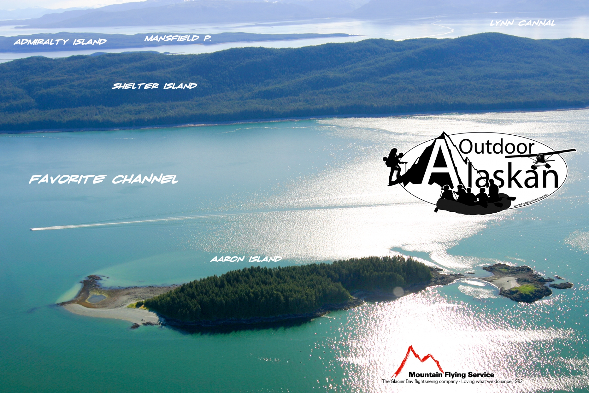
Information About

Barlow Islands

Quick Facts

Open in The Map Barlow Islands on The Map

Location

58 ° 23' 35.999" N,
134 ° 54' 16.999" W

Region

Hoonah-Angoon (CA)

Nearest City

Juneau

Barlow Islands in Detail.

About

Barlow Islands Gallery

Pictures of, from, or near Barlow Islands.

Places Near Barlow Islands
Cities:

Auke,

Archipelagos:

Barlow Islands,

Bars:

Cohen Reef, Dornin Rock, Eagle Reef, Faust Rock, Favorite Reef, George Rock, Hanus Reef, Horse Shoal, North Ledge, Poundstone Rock, Vanderbilt Reef,

Basins:

Cottrell Basin, Yankee Basin,

Bays:

Adams Anchorage, Amalga Harbor, Auke Nu Cove, Barlow Cove, Coot Cove, Crab Cove, Curlew Ledge, Eagle Harbor, Funter Bay, Halibut Cove, Hand Trollers Cove, Howard Bay, Huffman Harbor, Indian Cove, Lena Cove, Lincoln Anchorage, Pearl Harbor, Shelter Cove, Swanson Harbor, Tee Harbor, Yankee Cove,

Beaches:

The Sand Beach, Eagle Beach,

Capes:

Auke Cape, Barlow Point, Clear Point, Point Couverden, False Point Retreat, Point Howard, Indian Point, Inspiration Point, Point Lena, Point Louisa, Mansfield Peninsula, Piling Point, Point Retreat, Point Stephens, Symonds Point,

Channels:

Favorite Channel, North Pass, Saginaw Channel,

Cliffs:

The Breadline, Sharp Ledge,

Islands:

Aaron Island, Ansley Island, Bare Island, Barlow Island, Benjamin Island, Bird Island, Coghlan Island, Cohen Island, Colt Island, Couverden Island, Couverden Rock, Entrance Island, Gauge Island, Gull Island, Horse Island, Hump Island, Indian Island, Kishbrock Island, The Kittens, Ledge Island, Lincoln Island, Little Island, Lynn Sisters, Naked Island, North Island, Portland Island, Ralston Island, Rat Island, Rocky Island, Sentinel Island, Shelter Island, Star Rock, Station Island, Strauss Rock,

Lakes:

Peterson Lake, Salt Lake, Shelter Lake, Windfall Lake,

Mountains:

Auke Mountain, Green Mountain, Lone Mountain, Mount Robert Barron, Snowy Mountain, Thane Mountain,

Parks:

Auke Recreation Area, Funter Bay State Marine Park, Shelter Island State Marine Park,

Rivers:

Eagle River, Herbert River,

Streams:

Bear Creek, Bessie Creek, Boulder Creek, Cordwood Creek, Goose Creek, Lena Creek, Peterson Creek, Shrine Creek, Slate Creek, Tee Creek, Tenk Creek, Tusta Creek, Windfall Creek,

Routes:

Amalga Trail, Bear Creek Trail, Bessie Creek Trail, Herbert Glacier Trail, Montana Creek Trail, Windfall Lake Trail, Yankee Basin Trail,

Valleys:

Prairie Basin,

Cities:

Dobson Landing, Fairhaven, Funter, Lena Beach, Saint Terese, Tee Harbor,